Eye4Software Hydromagic
Eye4Software Hydromagic is a Hydrographic Surveying software product. It is used by survey, mining and dredging companies all over the world to perform hydrographic surveys in rivers, oceans, ponds and reservoirs. Using a positioning system like a GPS or RTK receiver, together with a hydrographic echosounder, position and depth data is recorded.
The collected raw data can be post processed and used to generate volume reports, depth maps, depth contour maps and much more. The development of Hydromagic has started in 2001 and is sold worldwide since 2011.
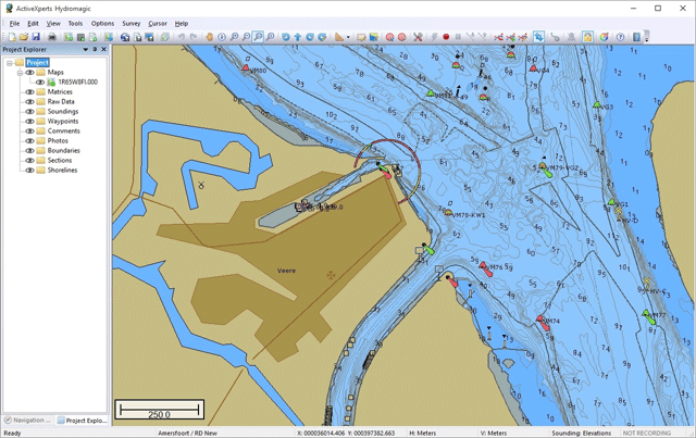
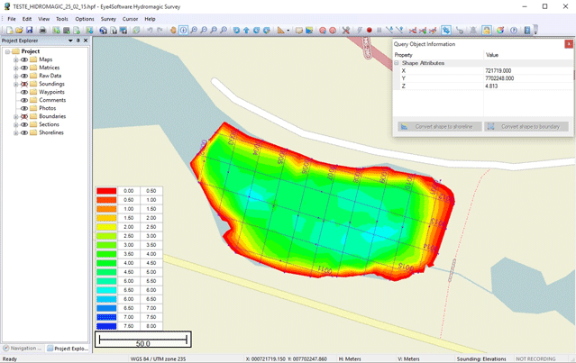
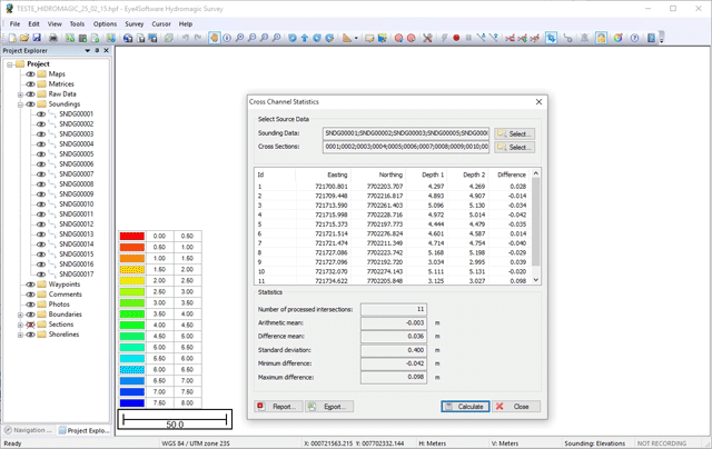
Screenshots
Supported Hardware
GPS Receiver and RTK Receivers
All NMEA0183 compatible GPS and RTK receivers are supported by Hydromagic. The GPS receiver is used to locate position; The RTK receiver is used to enhance the precision of the location.
Echo Sounders
Eye4Software Hydromagic works with all NMEA0183 compatible echosounders producing the NMEA formatted output. Besides that, more advanced formats like DESO25, Odom SBT, Odom DBT, PMC and ODEC are supported. The software is fully compatible with well-known (dual frequency) echosounder brands like Odom, STN Atlas, SyQwest, CEE HydroSystems and more.
Total Stations
In situations where there is no GPS coverage, or no RTK correction signal can be obtained, you can also use a total station as positioning system. Supported are Trimble total stations, and total stations outputting pseudo NMEA0183 (GGA sentence).
Product Features
Background maps
- Import AutoCad DXF, MicroStation DGN and GeoTIFF files as background map
- Use electronic nautical charts, IHO S57 and IHO S63 maps are supported
- Built-in map downloading tool lets you download map data from sources like OpenStreetMaps, Bing Maps and more
- Geo-reference scanned maps, or use image files with accompanied world file
Data display and recording
- Real time display of incoming data like position data, sounding depth and motion sensors
- Real time tide correction when a RTK positioning system is used and a geoid model is loaded
- Map display showing the actual position of the vessel
- Time tagged recording of all raw data including latency information
Raw data processing
- Correct your sounding data for tides, draft and sound velocity
- Built in filter tool to remove out of range sounding data
- Echogram editor and filter to manually or automatically remove spikes from the sounding data
- Position editor and filter to manually or automatically remove invalid position fixes
- A table editor allows you to edit all values by hand
Post processing
- Generate matrix (also called digital terrain model) from filtered and corrected sounding data
- Volume calculations by comparing different matrices
- Volume calculations using cross sections (channels)
- Staging reports for ponds and frac pits
- Cross section statistics
- AutoCad DXF, Google KML and ASCII exporting functions
Supported Platforms
Hydromagic requires a Windows desktop platform. It runs on any 64/32-bit Windows 10, Windows 8, Windows 7 and Windows Vista platform.
More information
To read more about Eye4Software Hydromagic, please visit the Eye4Software website at www.eye4software.com


